
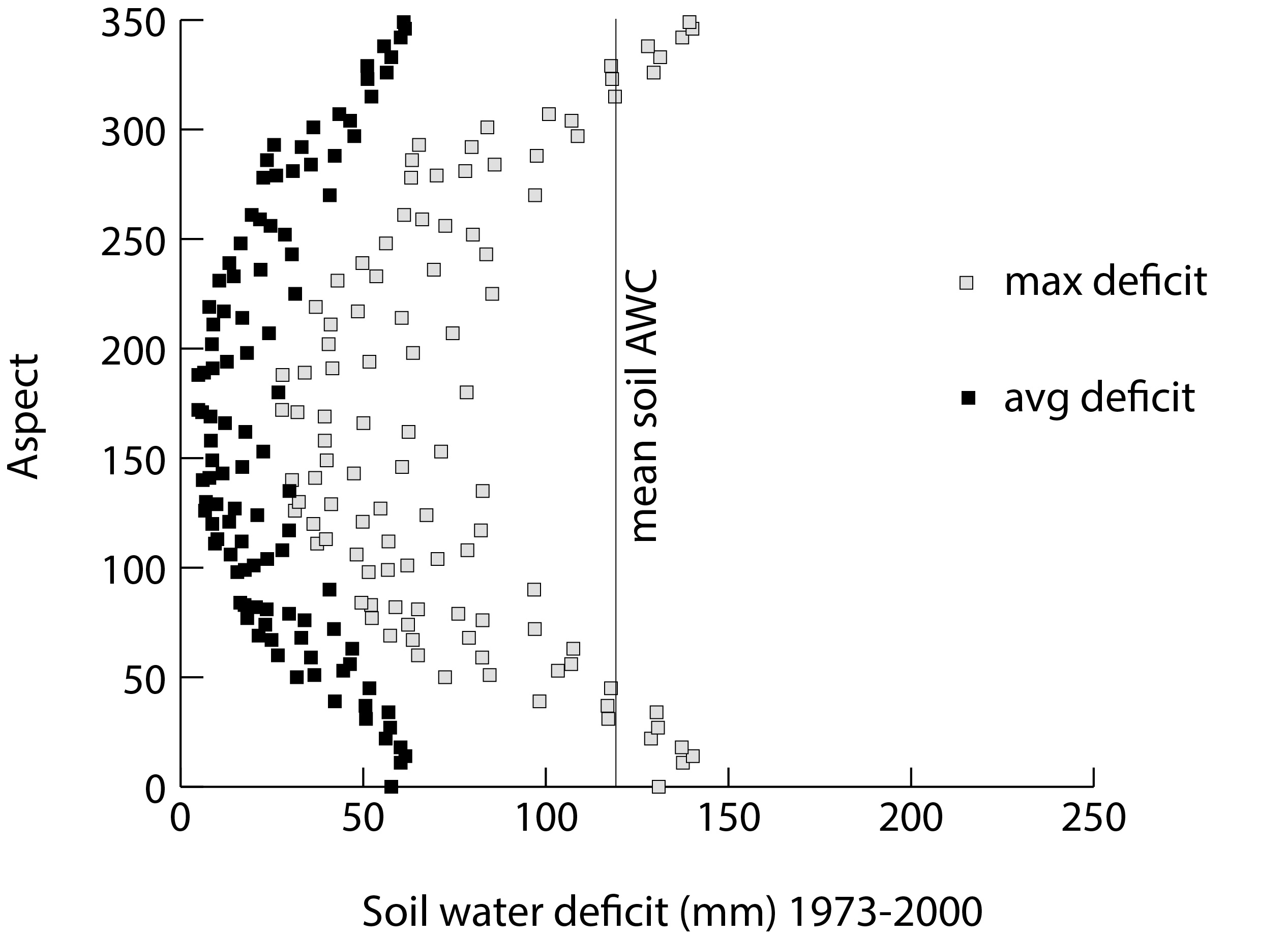
This project models water balance in mountain environments at the landscape scale. It uses local weather station data, gridded climate maps (CHELSA, WorldClim), and regional climate projections (e.g., INPE Eta) to identify potential past, present and future limitations to forest growth. The results will serve as a basis for validating Earth System models and biogeographical theory regarding the potential origin of areas with open vegetation together with their suite of endemic plant and animal species.
Reference: Dyer, J.M. 2019. A GIS-based water balance approach using a LiDAR-derived DEM captures fine-scale vegetation patterns. Remote Sensing 11(20): 2385. https://doi.org/10.3390/rs11202385
Investigator
Timeline
-